Early Snowstorm Blankets New York City, Causing Travel Disruptions and Arctic Cold
Heavy Early Snowstorm Hits New York City, Bringing Travel Chaos and Freezing Temperatures
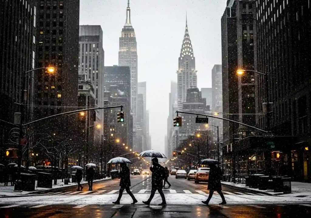
A major and unusually early snowstorm blanketed New York City on Sunday, marking the heaviest snowfall the city has seen in years and causing widespread travel disruptions along with the onset of dangerously cold temperatures. This unexpected winter blast transformed the urban landscape into a bright white scene while simultaneously creating difficult conditions for residents and travelers.
Across the region, the storm delivered heavy snowfall throughout Sunday morning. Most areas of New York City and the New Jersey metro region recorded accumulations ranging from three to five inches. Farther east, particularly on Long Island, some communities reported significantly higher totals, with nearly eight inches covering the ground in certain locations. Meteorologists noted that the snowfall measured in Central Park was the largest for this early point in the season since 2019.
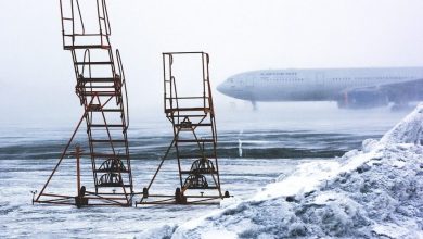
The sudden snowfall severely complicated travel, especially air traffic at the region’s major airports. Flights heading to John F. Kennedy International Airport and LaGuardia Airport were subject to ground stops Sunday morning, leaving many aircraft stranded at their departure airports for several hours. By early afternoon, delays continued to worsen, averaging about 90 minutes at LaGuardia and nearly one hour and 45 minutes at both JFK and Newark airports, disrupting travel plans for thousands of passengers.
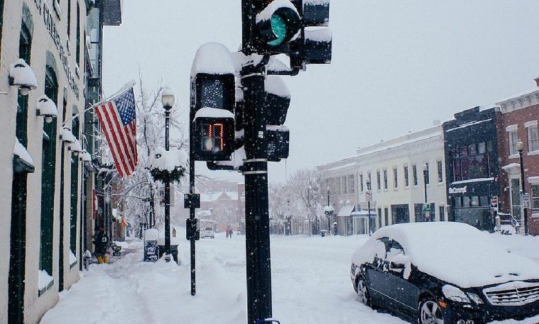
Road conditions deteriorated rapidly as the storm progressed, with many untreated surfaces turning into hazardous icy patches. Travelers were urged to exercise extreme caution, and warnings were extended into Monday morning due to freezing conditions expected overnight. While this storm represents a sharp contrast to several recent winters marked by below-average snowfall, meteorologists caution that it is too early to predict the pattern for the remainder of the season. Forecasts beyond one to two weeks remain uncertain, though the region is currently experiencing a weak La Niña pattern, which typically points to snowier conditions in parts of the northern United States.
Following the weekend snowfall, the coldest air mass of the season is expected to move into the city. Overnight temperatures are forecast to drop into the 20s, accompanied by strong, gusty winds. This combination will make conditions feel significantly colder, with wind chill values potentially falling to between zero and five degrees above zero. A brief warm-up is expected midweek before a “fully rain-based event” arrives on Thursday.
Meteorologists issued strong warnings about the dangerous combination of melting wet snow and sharply falling temperatures, which is expected to create treacherous icy conditions, particularly on untreated surfaces. “Anything left on untreated surfaces will freeze solid,” one meteorologist said, highlighting the risks facing drivers and pedestrians during the Monday morning commute.
Despite the challenges, some New Yorkers found joy in the winter scenery. A resident who works in Lower Manhattan expressed enthusiasm, saying, “I love it. I love winter, I love snow. It just makes the city look clean and fresh for a moment.” This sentiment captures the dual nature of winter’s arrival—its beauty alongside its practical hardships.
As snowfall tapered off by the afternoon, the city braced for the incoming cold wave and icy conditions, serving as a stark reminder of winter’s strength. Residents are advised to stay updated on weather alerts and travel advisories throughout the week, adapting to both the beauty and the challenges brought by this significant early-season snowstorm.