Severe Coastal Storm Expected to Hit North Carolina and U.S. East Coast This Weekend
The National Weather Service warns of damaging winds, heavy rainfall, and coastal flooding as a powerful non-tropical storm approaches the Eastern Seaboard.

Meteorologists at the National Weather Service (NWS) have issued urgent warnings to thousands of residents along North Carolina’s coastal regions about possible property damage, major road closures, and severe weather impacts as a powerful storm system approaches the Eastern Seaboard this weekend.
According to the agency’s latest bulletin, the storm is expected to bring strong winds, heavy rainfall, and coastal flooding, along with dangerous rip currents and significant beach erosion. Although the system is not classified as a tropical cyclone, officials warned that its effects could still be “major.”
Alex DaSilva, a hurricane expert at AccuWeather, noted that the approaching system “may produce impacts similar to those of a tropical storm,” even without receiving an official name from the National Hurricane Center (NHC).
NWS Warns of Rising Coastal Flood Risks Along the East Coast
Starting Wednesday, local weather offices began issuing multiple watches and warnings covering most of the U.S. East Coast. These include coastal flood advisories and high surf warnings. Water levels are projected to rise two to four feet (60 to 120 centimeters) above normal in low-lying coastal and waterway areas, posing a direct threat to homes and seaside structures.
The NWS office in Morehead City, North Carolina, cautioned that “flooding could extend into residential areas, threatening homes and businesses,” and warned of potential closures of several key routes, including Highway NC 12, which may become impassable in sections of Ocracoke and Hatteras Islands due to seawater overflow.
Officials urged residents to avoid driving through flooded roads and to respect warning barriers, emphasizing the need to protect property located in flood-prone zones.
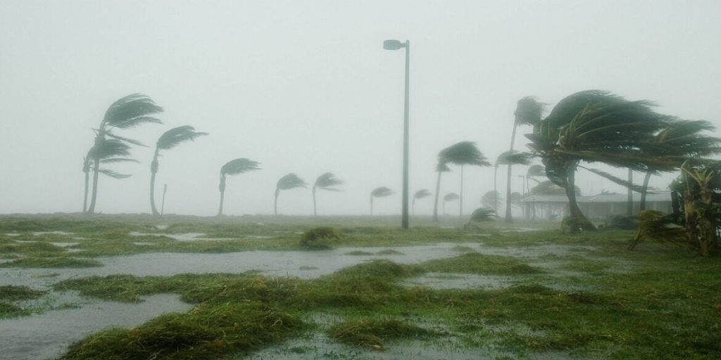
Forecasts indicate that coastal wind speeds may reach 45 mph (72 km/h) — equivalent to tropical storm strength — with extremely dangerous rip currents that could threaten the lives of swimmers and surfers.
In an official statement, the National Weather Service said:“A coastal low-pressure system is expected to form off the Carolinas late this week and strengthen gradually, potentially producing significant impacts along much of the U.S. East Coast.”
Local authorities continue to urge coastal and low-lying communities to stay alert, monitor weather updates, and take all necessary precautionary measures ahead of the storm’s arrival.