Michigan: The Great Lakes State and the Heart of Arab-American Life
History, geography, economy, and the largest Muslim community in the United States.
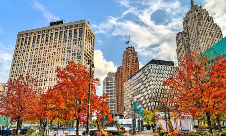
Michigan — known as the “Great Lakes State” — lies in the northern United States and ranks 22nd in size among all American states. Its geography is remarkably diverse: surrounded by four of the Great Lakes, Michigan boasts the longest freshwater coastline in the country and is the only U.S. state made up of two peninsulas. It is also home to the largest Arab and Muslim community in America, centered mainly in the city of Dearborn.
Location
Michigan is located in the northern U.S., east of Wisconsin. It is bordered by Indiana to the south and Ohio to the southeast, and shares an international border with Canada.
It is surrounded by Lake Superior to the north, Lake Michigan to the west, and Lake Erie to the south, and shares water boundaries with Wisconsin and Illinois through Lake Michigan.
Area & Population
Michigan’s land area covers around 56,591 square miles, while its water bodies span 40,097 square miles, placing it 22nd among U.S. states in total size.
According to the U.S. Census Bureau, Michigan had 10,077,331 residents in 2020, ranking it the 10th most populous state.
Name Origin
The name “Michigan” comes from the Indigenous word Michigama, meaning “large lake,” a reference to its vast freshwater shores and more than 11,000 inland lakes.
Climate
Michigan has a moderate climate shaped by the surrounding Great Lakes—warm summers and cold, snowy winters. Annual rainfall ranges between 760 and 965 millimeters, with the southwestern area being the most humid.
State Flag & Symbols
Michigan’s flag was adopted in 1865, featuring the state coat of arms on a dark blue field.
• State Bird: American Robin (1931)
• State Fish: Brook Trout (1988)
• State Flower: Apple Blossom (1897)
Geography
Michigan’s two peninsulas are connected by the famous Mackinac Bridge (2,543 meters long).
-
The Upper Peninsula is known for forests, low hills, and Mount Arvon, the highest point at 603 meters.
-
The Lower Peninsula is mostly flat, with northern hills and sand dunes reaching up to 122 meters.
With more than 11,000 lakes, including the Detroit and Grand rivers, Michigan has one of the richest freshwater systems in the world.
Early History
Indigenous tribes such as the Ottawa, Ojibwe, Miami, and Potawatomi inhabited the region, forming alliances like the “Three Fires Confederacy.”
The French arrived in 1618 and controlled the region until the mid-1700s, when Britain took over after the French and Indian War (1754–1763).
By 1805, Michigan became a U.S. territory, and in 1837, it officially became the 26th U.S. state.
European Settlement
French explorers began arriving in the early 1600s, establishing trade networks and settlements such as Sault Ste. Marie (1668) and Detroit (1701). Relationships with Native American tribes shifted over time from conflict to alliances, trade, and intermarriage.Michigan as a U.S. Territory and State
By the late 1700s and early 1800s, the U.S. consolidated control over Michigan.
The state experienced rapid growth after the opening of the Erie Canal in 1825, which expanded migration and trade.
A border dispute with Ohio — known as the Toledo War — delayed Michigan’s statehood, but it finally joined the Union in 1837.
Economy
Michigan’s economy historically relied on agriculture, lumber, mining, and dairy. In the late 1800s, iron and copper mining fueled growth, and improved transportation connected the Great Lakes trade system.
In the 20th century, Michigan became the global center of the automotive industry, home to Detroit’s Big Three auto companies.
Economic crises in the 1970s and early 2000s affected jobs and industry, but the state diversified into technology, services, tourism, and education.
Today, tourism ranks third among Michigan’s revenue-generating sectors.
Agriculture
Michigan grows:
-
Corn (main crop)
-
Soybeans
-
Wheat
-
Sugar beets
-
Beans, potatoes, blueberries
It is also one of the largest U.S. producers of cherries, apples, and peaches.
Largest Arab & Muslim Community in the U.S.
Michigan hosts over 300,000 Muslims, many from Middle Eastern backgrounds, especially in Dearborn, which contains:
-
The Arab American National Museum
-
Some of the largest and oldest mosques in North America
A Key Swing State
Michigan shifted politically over the decades:
-
Republican stronghold in the 1970s–80s
-
Later part of the Democratic “Blue Wall”
-
Became a swing state in 2016, when Donald Trump won by fewer than 11,000 votes